
Pemberton Township ZIP Code Directory Coverage
USPS is the authoritative address-by-address check. The research found three common postal ZIPs associated with Township communities in official-address material: 08015, 08068, and 08064. They are useful starting points, but the evidence does not support treating them as hard municipal borders. Use an exact street address for the final answer, especially where a Pemberton label can also point to Pemberton Borough or another nearby community.
| ZIP | Areas Covered | Post Office | Notes |
|---|---|---|---|
| 08015 | Browns Mills area of Pemberton Township | Browns Mills postal community; exact station not verified in the research | Pemberton Library has a Browns Mills 08015 address; check each address's civil municipality |
| 08068 | Pemberton postal area used by Township and Borough addresses | Pemberton Post Office | Postal Pemberton does not distinguish a Township parcel from a Borough parcel |
| 08064 | New Lisbon postal clue for eastern and rural Township research | New Lisbon postal community; address result verification needed | Confirm USPS result and Township boundary for the specific location |
Secondary lists also suggested nearby labels such as Birmingham, Juliustown, Mount Holly, Vincentown, and Joint Base McGuire-Dix-Lakehurst. They are not counted here because the research did not find an official USPS municipality-boundary table that confirms them as Township-wide coverage. Treat them as address-specific leads only.
Pemberton ZIP Codes Need Address Checks
A city line, a postal city, and a delivery ZIP answer different questions. A Township parcel may receive a Browns Mills, Pemberton, or another postal label. A Borough address can share the Pemberton label. The right order is to preserve the postal result, identify the legal municipality, and then check the parcel or tax record. Skipping the middle step can put a real address into the wrong government jurisdiction.
New Jersey's official Municipality Lookup provides a second check when city and ZIP information are available. It is a normalization tool, not a resident list. Use it after USPS and before relying on a county record, then verify the property through Pemberton's tax resources or the county GIS route. The local distinction is especially important because Pemberton Township formed in 1846, Pemberton Borough separated in 1894, and a portion returned in 1965.
Use the New Jersey Municipality Lookup to compare a postal-place result with the standardized municipality.
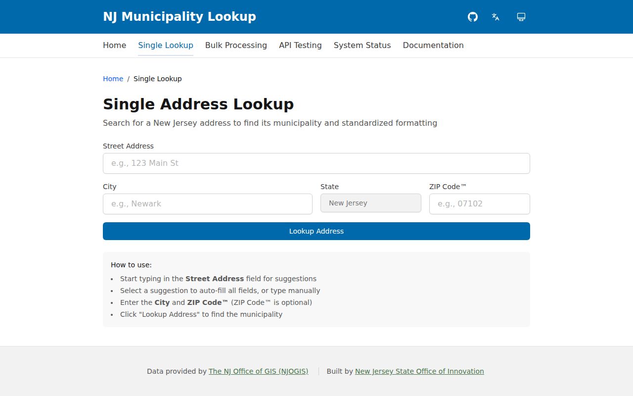
That two-step check keeps a mailing label from being treated as a legal boundary, which is the key safeguard for a Pemberton-area address search.
Pemberton USPS ZIP Code Search Fields
USPS offers three useful modes: an address lookup, a city and state lookup, and cities by ZIP. The address mode is the best choice when a house number and street are known. Add a unit where one is available, because it can narrow a result. USPS also cautions that a ZIP match does not confirm a person or company at the location, so it should be treated as postal evidence only.
| Mode or field | Type | Required | Format or use |
|---|---|---|---|
| By Address: Company | Text | No | Company name when relevant |
| By Address: Street Address | Text | Yes | Street address, with unit added when known |
| By Address: Apt/Suite/Other | Text | No | Unit or suite |
| By Address: City | Text | Yes | Postal city |
| By Address: State | Dropdown | Yes | Choose the state |
| By Address: ZIP | Text | No | Optional narrowing ZIP |
| By City and State | City text and state dropdown | Yes | Postal-place lookup |
| Cities by ZIP | ZIP text | Yes | Enter the ZIP to see associated city names |
| Find | Button | Yes | Result details vary by selected mode |
Write down the exact street, unit, city, state, and response before moving to a land or tax search. The address is the bridge. A broad city result can be useful for postal vocabulary, but it does not place an individual parcel inside Pemberton Township.
Pemberton 08068 Postal Clue
The official USPS location record identifies the Pemberton Post Office at 73 Elizabeth Street, Pemberton, NJ 08068-9998. Listed retail hours are Monday through Friday from 9:00 a.m. to 5:00 p.m. and Saturday from 9:00 a.m. to 1:00 p.m.; the listed telephone is 609-894-2686. The facility record confirms an official postal location and a mailing ZIP clue. It is not an address-occupancy record and does not prove that every 08068 address lies in the Township.
| Facility | Pemberton Post Office |
|---|---|
| Location | 73 Elizabeth Street, Pemberton, NJ 08068-9998 |
| Retail hours | Monday-Friday 9:00 a.m.-5:00 p.m.; Saturday 9:00 a.m.-1:00 p.m. |
| Telephone | 609-894-2686; USPS general help 800-275-8777 |
| Record limit | Facility-location detail only; no person record or address-occupancy proof |
See the USPS Pemberton Post Office location record for the current facility details.
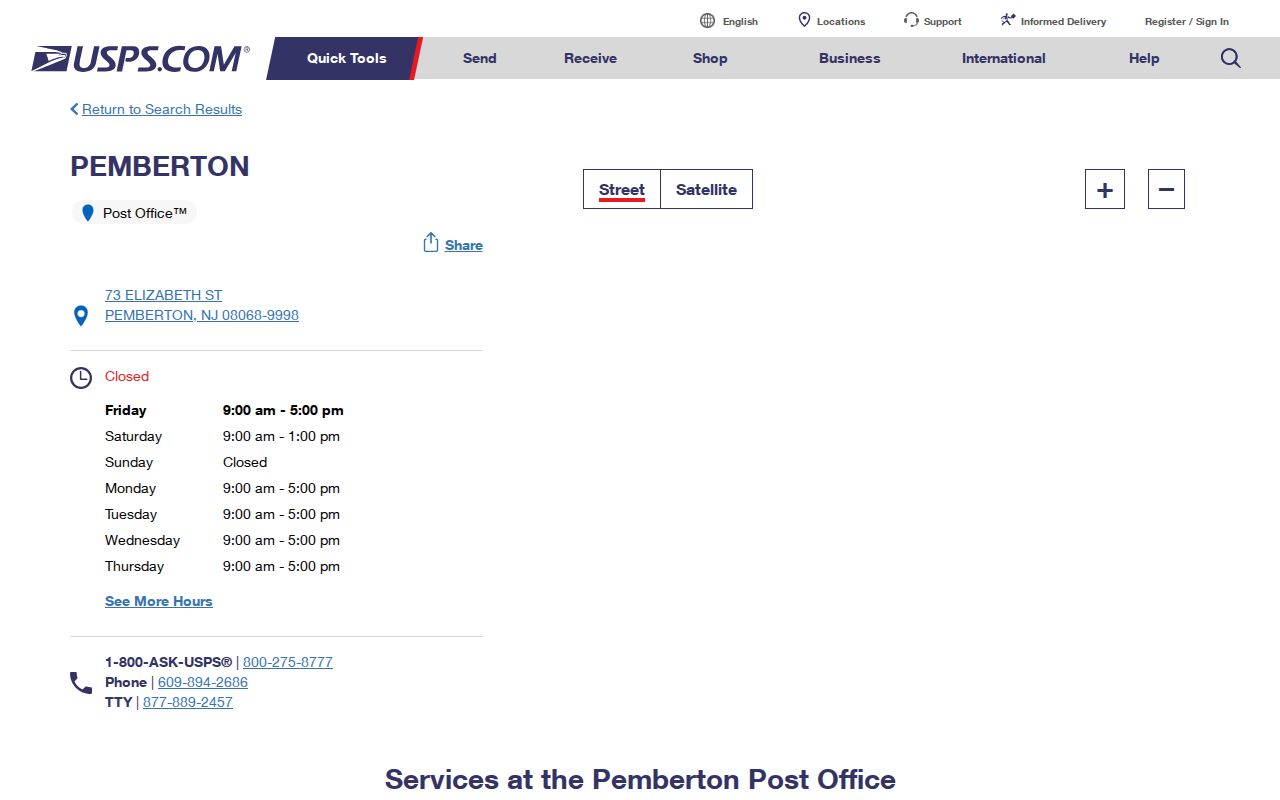
Use the facility as a postal reference point, then return to an exact address, municipality result, and parcel source before drawing a Township conclusion.
Narrowing a Pemberton ZIP Search
Postal information can narrow an address search, but the available official sources do not support a broad ZIP-only resident search. Pemberton WIPP was JavaScript-rendered during research, so its current field set and any ZIP or mailing-address filter must be verified live before it is described as a search option. PRESS has no ZIP field. It searches by municipality, block and lot, owner, document type, or date. Convert a postal clue into a specific address or parcel first.
- Use USPS by address to confirm the mailing ZIP for the exact street address and unit.
- Use the New Jersey municipality tool to distinguish the postal place from the civil municipality.
- Find the parcel's address, block, and lot through Pemberton tax resources or the documented county GIS route when available.
- Search PRESS with municipality plus block and lot for recent instruments, or owner name for the stated middle-era limitation.
- Compare tax owner, recorded party, and occupant carefully because they are not interchangeable facts.
Once the address is settled, the Pemberton Township Street Directory has the fuller street-level record path. The County GIS public Property Viewer and mapping application were reported offline, so the guide and parcel-download information are fallbacks, not a promise of a live map.
Pemberton Property Records Beyond ZIP
Pemberton's WIPP property-tax portal and the New Jersey Property Explorer can help turn a location into a parcel or tax record. The statewide source says annual lists are filed in January, so a later ownership change may not appear until a later list. Map-format information can include location or owner, block and lot, assessed land and building values, prior-year taxes, and property class. It is tax-assessment information, not a complete current-title or occupant record.
The distinction is important. A situs address is where a parcel sits. A tax owner or taxpayer is a name carried by an assessment source. A mailing address can belong to an entity, trust, estate, lender, or tax service. Recorded deed title comes from the County Clerk's land-record trail. Each source answers a different question and should be cited separately.
Consult the New Jersey local property-tax information for the statewide framework.
The tax route is most useful after an address is normalized. It should not be used to turn a postal ZIP into a claim about who currently lives at a parcel.
Pemberton ZIP History Is Unverified
No official Pemberton-specific ZIP realignment history was found. A changed postal label is therefore not evidence that a household moved, that a street changed municipalities, or that an annexation occurred. Preserve the original mailing label in a historical note, then compare it with a current USPS result and the municipality lookup. That careful record of change is more useful than assigning an unsupported boundary-change date.
The same caution applies to older records that say only Pemberton. The Township, Borough, village, and postal place have overlapping names but different administrative meanings. For historical research, maintain a small timeline beside the address: source date, printed place name, postal result if known, legal municipality check, and parcel or deed reference where available.
Pemberton Township Records Geography
Eastern Pemberton Township adds a practical geography issue to postal research. State planning material places much of the area within the Pinelands and describes development around Browns Mills, Pemberton Borough, and lake communities. County GIS layers can include waterbodies, road jurisdiction, abandoned rail, highway overlays, municipal boundaries, and Pinelands coverage. They explain local context, but they are not resident records.
A parcel that looks close on a map can be separated by water, a road jurisdiction, or a municipal line. The documented Pemberton parcel file is named pember.shp and has tax-lot boundaries dated December 2015. Its date is provenance, not evidence of current ownership. When the public viewer is offline, call Burlington County GIS at 609-265-5125 or use its published guidance and download route before assuming a current map is available.
- ZIP
- A postal delivery code that helps route mail. It is not a municipal boundary or a resident roster.
- ZIP+4
- An added four-digit delivery detail that narrows mail routing within a ZIP; it does not establish civil jurisdiction.
- PO-box ZIP
- A postal code used for post-office boxes. It should not be read as a geographic area of homes or parcels.
- Unique ZIP
- A ZIP assigned to one organization or destination. No such Pemberton Township ZIP was verified in the research.
- Carrier route
- A delivery grouping used by the postal service. It is a route concept, not a legal boundary.